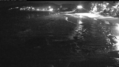
Tha Chin
![]() Tha Chin, Thailandia
Tha Chin, Thailandia
Real-Time Environment
Welcome to the live streaming webcam for Tha Chin, perfectly situated in the vibrant region of Tha Chin, Thailandia. Watching this live camera allows you to instantly experience the local atmosphere and monitor current climate conditions.

About Tha Chin
Il fiume Tha Chin è un effluente del Chao Phraya e scorre nella parte ovest della grande pianura alluvionale che forma la Thailandia Centrale. È lungo circa 325 km e sfocia con un estuario nella baia di Bangkok. Tha Chin è l'antico nome di Samut Sakhon, la città dove il fiume sfocia in mare, così chiamata probabilmente per il grande numero di giunche cinesi che attraccavano nel suo porto.
📖 Read more on Wikipedia📍 Location Facts
-
Country
 Thailandia
- Region unknown
- City Tha Chin
- Coordinates 13.5435°N, 100.2459°E
Have you been to Tha Chin?
Help the community! Share your experience, tell us about the weather, or upload your own photos from this exact location.